Just thought I’d open up a thread. This is for us Floridians to give people a personal view of the weather where each of us live, So I’m hoping Joseph, RH, Lamby, Tony, et al. will keep us (and you all) posted. Stay safe, and keep watching the skies.
It is now 21:33 hours (9:33PM) just West of Orlando, Florida. It has now been raining for about 40 minutes. It started off slow, but now, on a scale from 1-5 (1:Sprinkle-5:Torrential) I’d say I’m around a 3.5. I’ve had a few lightning strikes in the area. Our pond did seem lower than usual, so hopefully that will hold all the rainwater to fall in the next few days. Windwise, I’d say its anywhere between 5-15 MPH out there. I’ve gone ahead and moved the dogs into our patio, where it is nice and dry (except for the lab, which likes to lay in the rain for some odd reason). I’ve set candles and flashlights all throughout the house just in case the power goes out. I’ve got a small cooler with disposable ice packs in it (just in case the power goes out, for my grandma’s insulin.) We’ve also gone ahead and put all of our important stuff in a tote container, just in case we have to get the heck out of dodge. This includes important papers, prescription meds, all my whistles, items of sentimental value, and a small bag of dog food (for the dogs, naturally). We’ve gone ahead and secured all the “moveables” that were outside, shut off the breakers to out workshop/apartment and to the washer/dryer. My brother also brought down an old tree (not a big one) that was on its last limb. I really liked that tree. Well, as I draw this update to a close, the rain is starting to subside. Thunder looms in the distance…
How far west of Orlando are you? I live west of Orlando. From I-4, just up hwy 27 about 7 miles.
no rain here in Broward yet, just warm and windy.
the house is shuttered except for the Florida room, and i’ve got the remaining panels inside in case the wind gets too strong and i need to shutter inside the enclosure.
the TV stations are mostly killing airtime, interviewing the people hanging out in the street who haven’t got the sense to be home at this hour… i’ve been away at a conference all day but my wife has been home with our son and she says the TV coverage really increases the anxiety level… so we’ve got it on, but just look in from time to time to see what the satellite is showing.
i had lunch this afternoon at a lovely NY-style deli in Deerfield Beach, and as i was leaving, the farewell was “stay safe”, which is pretty much all you can say at a time like this… so to all here in the path of Wilma, stay safe.
Hey JES, I’m a few miles NW of the SR50- Hwy 27 junction.
We could be neighbors.
Ask her if she’s missing any lawn ornaments . . .
Looking a little worse here . . .
WILMA HAS CONTINUED TO BECOME BETTER ORGANIZED THIS EVENING WITH THE
LARGE 45 NMI DIAMETER BECOMING VERY DISTINCT IN BOTH SATELLITE AND
RADAR IMAGERY. AIR FORCE RECON FOUND 700 MB FLIGHT-LEVEL WINDS OF
114 KT IN THE NORTHEAST QUADRANT AT 0104Z… WHICH EQUALS ABOUT 103
KT SURFACE WINDS. DOPPLER VELOCITY DATA FROM KEY WEST HAS ALSO BEEN
AS HIGH AS 109 KT AT 12000 FT. THE CENTRAL PRESSURE HAS DECREASED
TO 958 MB… OR ABOUT 104 KT USING A STANDARD PRESSURE-WIND
RELATIONSHIP. BASED ON THIS WIND INFORMATION AND THE CONTINUED
INCREASE IN THE EYEWALL CONVECTION… > THE INITIAL INTENSITY HAS
BEEN CONSERVATIVELY INCREASED TO 100 KT… OR CATEGORY THREE/MAJOR
HURRICANE STATUS> . A RECON VORTEX MESSAGE JUST HANDED TO ME NOW
INDICATES THE PRESSURE HAS DECREASED TO 957 MB.
.A TRACK FROM COLLIER COUNTY TO NEAR LAKE
OKEECHOBEE AND EXITING PALM BEACH COUNTY DURING THE NEXT 18 HOURS
SEEMS QUITE REASONABLE. HOWEVER… > GIVEN THAT WILMA HAS A 40-50 NMI
DIAMETER EYE… HURRICANE-FORCE WINDS WILL EXTEND WELL AWAY FROM
WHERE THE EXACT CENTER PASSES.WILMA IS EXPECTED TO BE A
MAJOR HURRICANE AT LANDFALL ALONG THE SOUTHWEST FLORIDA COAST EARLY
MONDAY MORNING. HOWEVER… ANOTHER 5-KT INCREASE IN INTENSITY MAY
OCCUR > WHILE WILMA REMAINS OVER THE SLIGHTLY WARMER GULF LOOP
CURRENT. GIVEN THE FAST FORWARD SPEED EXPECTED AS WILMA TRAVERSES
THE SOUTHERN FLORIDA PENINSULA… LESS WEAKENING SHOULD OCCUR AS
COMPARED TO TYPICAL HURRICANES MOVING OVER LAND. THEREFORE… > WILMA
IS EXPECTED TO BE A CATEGORY TWO HURRICANE WHEN IT REACHES THE
FLORIDA EAST COAST> .
just after 3 am here, the last advisory has it strengthening, now a cat 3 with 120 MPH winds, moving NE @ 20 MPH. the eye is huge – 75 miles wide – and looks like the it’ll be skirting my neighborhood (maybe Tony’s, too) later this morning.
getting very gusty, but no significant rainfall.
At 3 a.m., the sustained wind speed was raised to 120 mph. (Edited to say good morning to rh and that I now see he just said the same thing!)
Things have worsened here. I can no longer see lights on the islands across the bay, except at the major hotels, so it looks like their power may be out.
There is a stiff wind with driving rain coming in from the north. My door knocker was banging, so I went out and took the knocker off.
Winds up to 65 mph due to begin arriving in an hour, with sustained tropical force winds between 7 and 11 a.m.
I just called work . . . we’ve not closed . . . ![]()
yup, the southern eye wall is headed for south Broward/north Dade, so looks like Tony and i are gonna get hammered here…
Hope it doesn’t strengthen further and that it weakens some. Remember . . . small, interior room . . . like a closet or utility room. Build a shelter over some major appliances by turning a table upside down and weighting it down with stuff to prevent the roof from falling in on you.
And did you brace your garage door? Even if the windows hold, they are now finding that the roofs go because the new, lightweight garage doors buckle and allow wind to enter and lift off the roof. I think they are recommending that you position your car’s bumper right against the door if you don’t have a reinforced door. Close the door, then back your car into it. The weight of the car prevents the door from blowing in. Maybe.
During Charley, a friend’s two daughters, who were living in a house they own outside of Orlando while attending college, phoned her to say that the roof had been making ominous creaking noises–they could feel it lifting the walls slightly–so they abandoned the bedroom for the hallway. Just as they did that, a tree branch plunged through the roof into the bedroom.
More branches started coming through, and a back section of roof started ripping off, so they and their roommate piled into the utility room, crouching between the washer and dryer. They spent nearly 3 hours there, calling mom on the cell phone every time another piece of roof would rip off or another branch would break through.
I was in Orlando for that one. There wasn’t much difference–only a few miles–between getting the devastating winds and the not-so-damaging winds. There were small trees and branches knocked down where I was, but just a few miles away whole neighborhoods were flattened. It was the difference between being on the side with the worse weather and the side that wasn’t.
We’ll hope you and Tony end up on the better side!
latest advisory in, pressure continues to drop, now at 950 mb with sustained winds of 125. the eye now looks to be about the distance between West Palm Beach and Miami. we’re getting some heavy gusts and sporadic downpours now.
lights are starting to flicker, so i’ll sign off for a while.
Good luck to you guys!!!
BBC Website is hours behind what’s actually happening there.
Thinking of you all, as I try to go about a “normal” Monday morning in the office.
5:33 am.


Some rain, some wind, but it’s picking up.
I went to bed around 2am and things were ‘kinda breezy’
The power went off around 5:30 and I finally got up at 6am tired, of hearing the beeping of the UPS’s. I’m on generator power now.
Every minute or so there are flashes of lightening and the winds are strong, probably 50-60mph. Gusts are estimated in the 80+ mph range.
I’m suprised there isn’t much rain.
I just checked the weather service images and it looks like the Southern most edge of the eye wall will pass over my area… this is usually the strongest winds of a hurricane.
Yeah man… it’s gusting pretty hard outside.
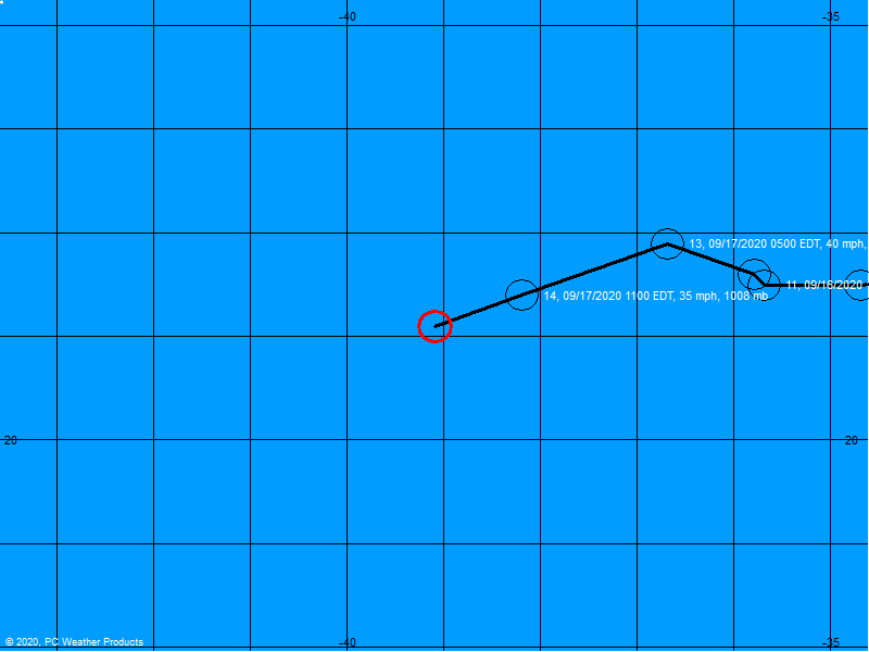
I think this image updates, but currently half of the eye is in land now.
Up here in Davenport, we have winds around 50moh, and rain… oh, and the odd tornado or two. Looks like this thing is going to whip on by pretty quickly. Good luck to you Tony, rh, Shadow, Lambykins and everyone else in this storm!
Are you talking to me??? Have I actually given off that impression???